
PROJECT DATES: OCTOBER 2007
BACKGROUND
The Brownsville Dam was located on the Calapooia River 3 miles upstream from the town of Brownsville at river mile 36.
The town of Brownsville has a valued history of water powered mills. The original dam was built in 1958 to direct water down a hand dug millrace to operate the Brownsville Milling Company’s grist mill. Later the woolen industry grew in the Willamette Valley and in 1868 Eagle Woolen Mills was built in Brownsville, which utilized the millrace. The Woolen Mill permanently closed in 1955 because of multiple fires and in the 1960’s the Brownsville timber crib dam washed away.
After the wooden dam washed away, the Linn-Lane Soil and Water Conservation District built the concrete Brownsville Dam at the request of community members. The sole purpose of the structure was to divert water to the Brownsville Canal for only three months of the year primarily for aesthetic purposes. Brownsville Dam did not impound water for flood storage, fire protection, drinking water or boating.
The Brownsville dam had not been officially inspected since its completion in 1969. The dam had evidence of structural damage that had gone unrepaired due to lack of resources. The downstream vertical concrete wall was in good condition, but its foundation had been undermined by turbulent flow to such an extent that a cavity existed behind the wall. A large gap existed at the base of the wall, but because the cavity was submerged, its dimensions could not be measured accurately.
Although the Brownsville Dam was small in size, its removal was significant for Oregon and the Pacific Northwest for restoring fish passage and habitat for spring Chinook and winter steelhead.
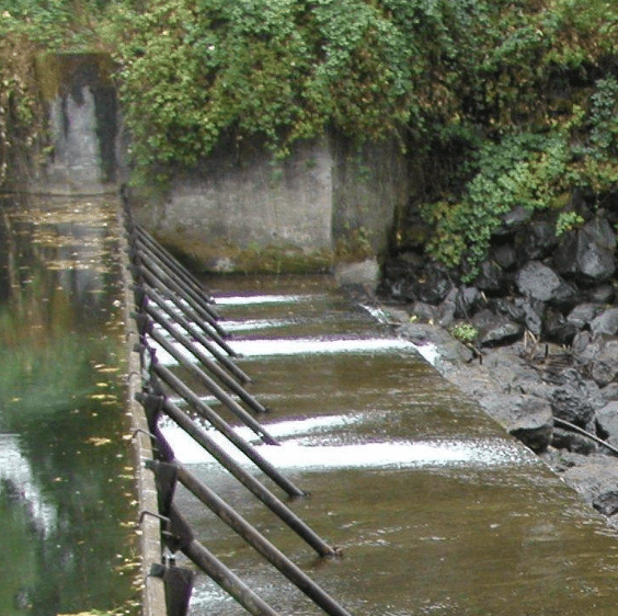
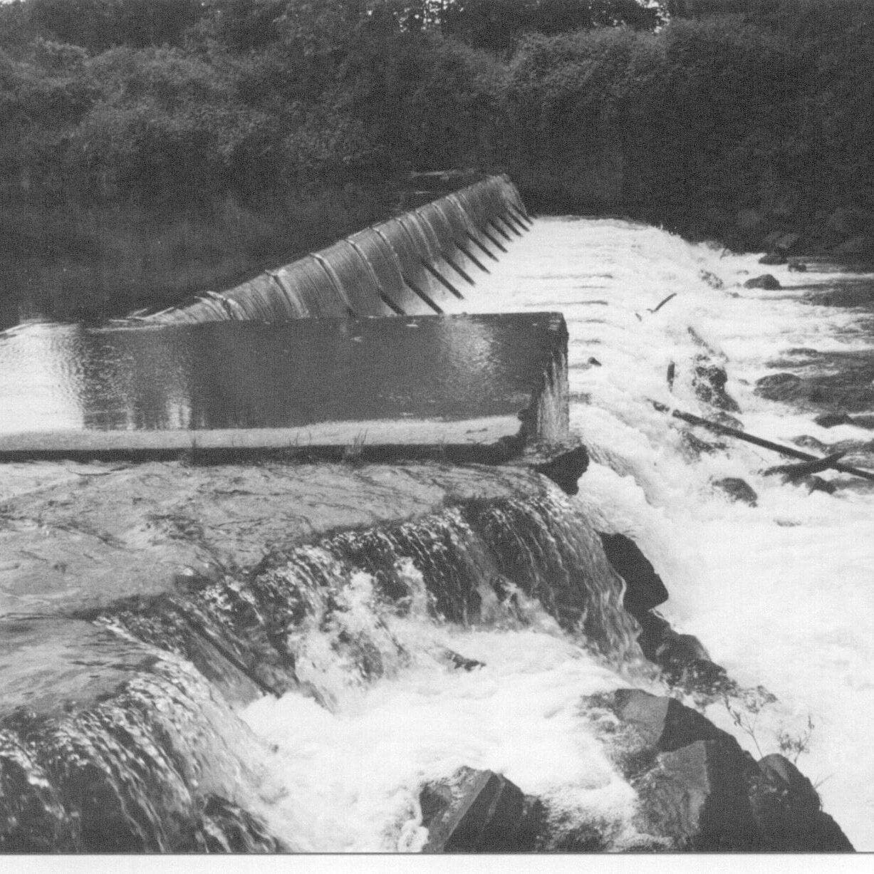
The dam was located between two concrete abutments located on either side of the Calapooia River, north to south. The dam structure was approximately 110 feet long, north to south and approximately 14 feet wide, east to west. Height of the dam faces were approximately 6 feet tall for the downstream (west) face and 8 feet tall for the upstream (east) face. Addition of the flashboards during summer months added additional 5 feet of height, which required Chinook salmon migration upstream to use a bedrock chute with flows often too high or low for passage.
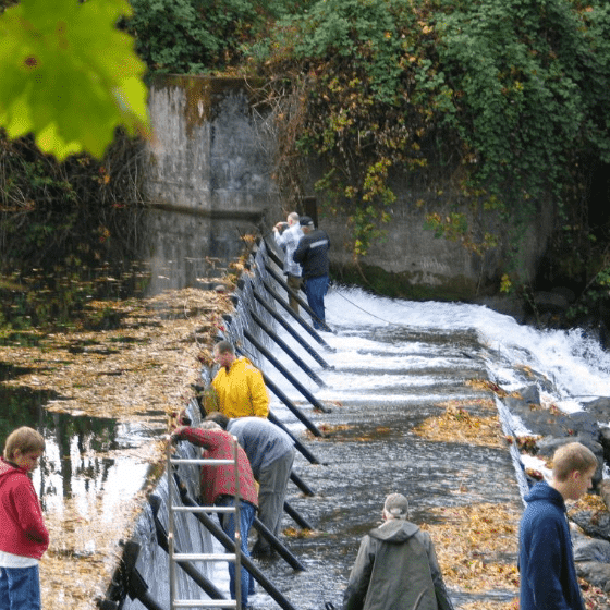
Every spring and fall the Brownsville Canal Company and community volunteers united for the big event of flashboard installation or removal. The added height of the pool created a favorite swimming hole for the community. Unfortunately the dam became a safety issue as kids were able to swim up under the hollowed dam as over the years the gravel fill began to disappear and the dam showed aging signs.
The Calapooia Watershed Council worked for more than four years with the Brownsville community to consider fish passage options for the dam.
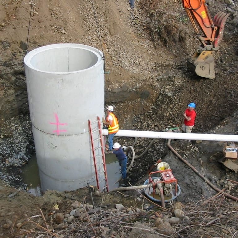
After years of public discussion, the Brownsville community stakeholders made the unanimous decision on January 11, 2006 to support removal of the Brownsville Dam with the caveat that water be maintained in the small, historic canal that runs through the City of Brownsville (2.5 cfs). A pump was installed Summer 2008 to meet the existing water rights in the Brownsville Canal.

Community Effort
The dam removal, five years in the planning, took only two weeks to implement. The removal was made possible by technical support and funding from numerous partners and especially because of countless volunteer hours from the watershed council and Brownsville community.


reports & assessments
Brownsville Dam Removal Pre-Implementation Monitoring Summary
Prepared for:
Calapooia Watershed Council & Oregon Watershed Enhancement Board
by Desiree Tullos, Oregon State University (September 30 2007)
effectiveness monitoring for brownsville and sodom dam removals
Prepared for:
Calapooia Watershed Council, Oregon Watershed Enhancement Board, Oregon Parks and Recreation Department
by Desiree Tullos, Oregon State University, Gordon Grant, US Forest Service
brownsville dam removal report
Prepared for:
Calapooia Watershed Council
by John Martin, RG, CWRE, Principal Geologist, Cascade Earth Sciences (October 2007)
before and after
brownsville irrigation diversion restoration report
Prepared for:
Calapooia Watershed Council
by by John Martin, RG, CWRE, Principal Geologist, Cascade Earth Sciences (May 2009)
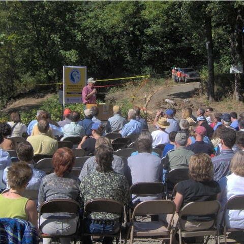
Stream Project Award
In April 2008, the State Land Board recognized the Calapooia Watershed Council and its many partners for the Brownsville Dam Removal in an awards ceremony honoring exemplary projects that promote responsible stewardship of Oregon’s
natural resources.
In presenting the Stream Project Award, Governor Ted Kulongoski, chair of the Land Board, commended the Council for developing a broad partnership to “Protect Oregon’s natural resources for future generations.” This project exemplifies the spirit of cooperation that is so important for a successful outcome.”
Project partners include the City of Brownsville, Brownsville Canal Company (private landowners), Linn County Parks and Roads Department, Bella Vista Foundation, Oregon Watershed Enhancement Board, Oregon Department of Fish and Wildlife, Oregon Water Resources Department, National Oceanic and Atmospheric Administration, U.S. Forest Service and the Bureau of Land Management and Cascade Pacific RC&D, as well as project consultants Cascade Earth Sciences in Albany, OR.