PROJECT DATES: 2012-2022
background
Bowers Rock State Park is a 568-acre area located on the upper reach of the mainstem Willamette River near its confluence with the Calapooia River, west of Albany. The Willamette Atlas depicts this section of the river as experiencing loss of channel complexity and floodplain function as measured by reduced channel length and simplified channel type (i.e. alcoves, side channels, islands.)
From 1850 to 1995, 70-80% of the islands and alcoves had been lost in this reach.
Flood control reservoirs and channel modifications such as revetments, and dredging have limited the river’s habitat forming processes. Cumulatively these impacts affect off-channel habitat function for migrating juvenile salmonids, especially smaller size classes (60-200mm) who preferentially seek out these quieter areas for forage and refuge.
At Bowers Rock State Park, the natural hydrology has been compromised by the development, then abandonment of a gravel pit along the southwest corner of the park.
Human-made barriers and embankments have disconnected side channels, sloughs and alcoves, resulting in compromised flow to the park’s floodplains.
Native riparian plant communities have also been impacted by introduced species colonization.
Pasture grasses, reed canary grass, and aquatic weeds such as water primrose have shifted historic food web productivity for prey resources important to juvenile salmonids.
Investment was made in data collection to better understand hydrologic and hydraulic processes in and around Bowers Rock State Park. These analyses characterize habitat forming processes at both the reach and local levels and have helped inform the restoration concepts.
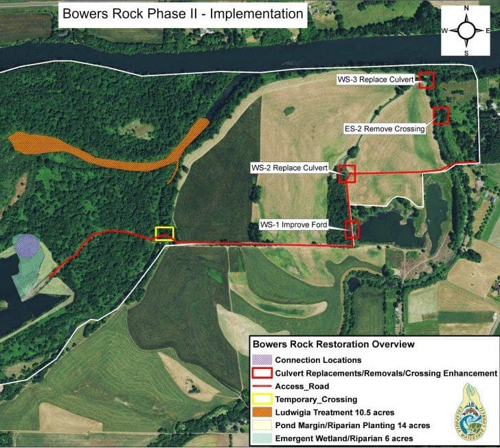
All concepts are centered around increasing Willamette mainstem complexity by restoring function to side channels, alcoves, floodplains and wetlands on State Park property. Additional enhancement work had been underway for the prior few years, including invasive plant removal and riparian plantings to augment and restore native plant community structure and function.
objective
The main goal of this project is to allow the Willamette River to access its banks during high water times as it would have before the introduction of dam structures over the last century.
These off-channel habitats during high water are very important for our native fish which include both Winter Steelhead and Chinook Salmon.
Oregon Parks and Recreation Department (OPRD), in partnership with the Calapooia Watershed Council, (CWC) worked toward moving forward with the restoration of OPRD’s Bowers Rock State Park for the best part of a decade.
The project became fully funded in 2019 .
implementation
The restoration at Bowers Rock State Park got underway in August 2020. The project had to be halted for a week due to the unprecedented wildfires that our state experienced. The work commenced once the rains had fallen and the air quality improved.
outcomes
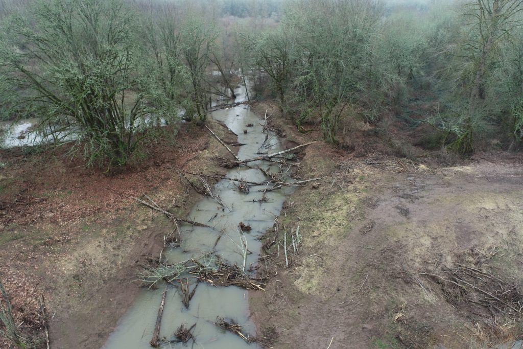
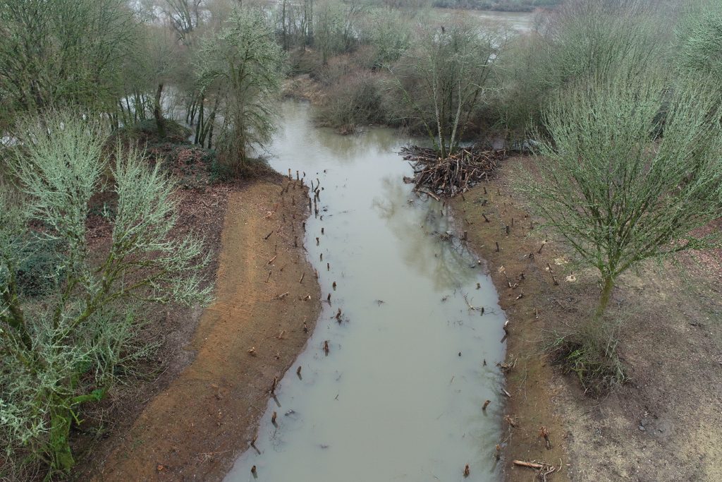
In winter of 2021, we were able to observe channel activation of both inlet and outlet channels.
In the spring of 2021 we were able to assess how well the native plants we installed the previous year had established themselves, and are pleased to report this was a great success. Those areas will continue to receive monitoring and invasive removal for five years with 2-3 visits per year. Project monitoring for all the work being completed will continue long-term to ensure the project meets its goals.
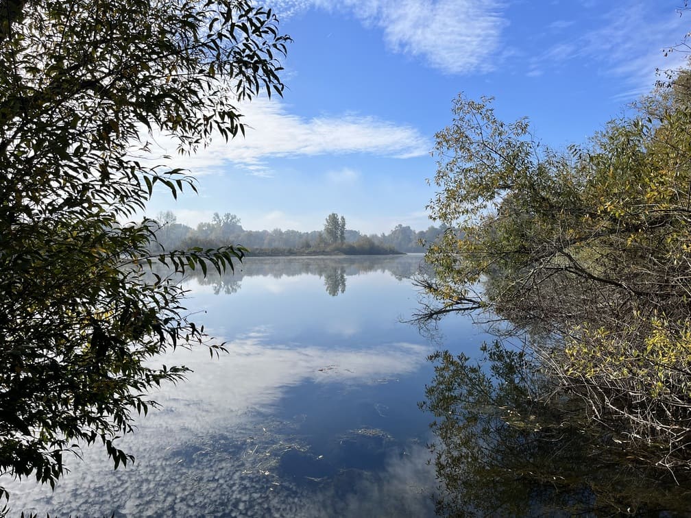
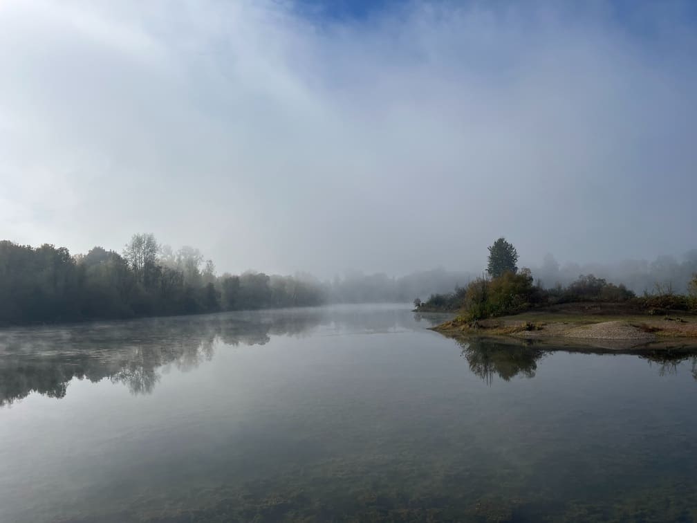
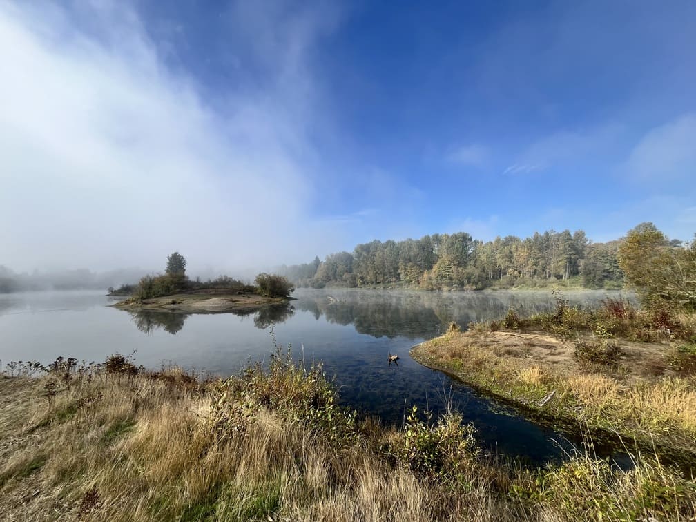
3 YEARS ON
Photos taken Fall 2024.